
Parametric Curve Drawing of Iran Map
Loading the math board and drawing, please wait…
In collections
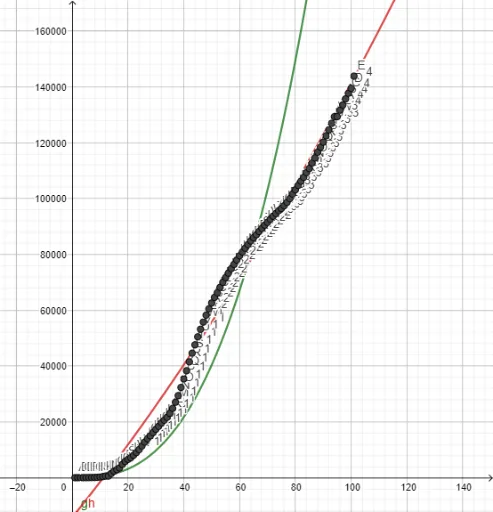
Confirmed Coronavirus Cases in Countries
This example demonstrates how to draw the map of Iran using parametric curves. Key mathematical concepts include parametric equations and coordinate geometry. By using the PolyLine command to connect multiple points and the FitPow and Fit commands to fit curves, it shows how to accurately draw complex geographical shapes. Suitable for high school math education and geography enthusiasts.
GeoGebra Commands & Parameters
PolyLine(l1) → fFitPow(l1) → gFit(l1, {1, x, x^(2)}) → h
AI Drawing Prompt Reference
Draw the map of Iran by connecting multiple points with PolyLine, then use FitPow to fit a curve, and finally adjust the curve with Fit to accurately depict the complex geographical shape.
The prompt above was compiled from the original drawing commands and is for reference only.