
Swiss Terrain Map
Loading the math board and drawing, please wait…
In collections
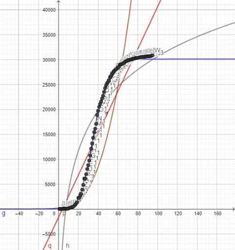
Confirmed Coronavirus Cases in Countries
This example demonstrates the terrain features of Switzerland by drawing polygons and curves. Key mathematical concepts include polygons, function fitting, and locus. Commands used include PolyLine, FitLogistic, FitPow, and FitLog. Suitable for high school mathematics education and learning coordinate geometry.
GeoGebra Commands & Parameters
PolyLine(l1) → fFitLogistic(l1) → gFitPow(l1) → pFitLog(l1) → h
AI Drawing Prompt Reference
Draw a Swiss terrain map featuring multiple polygons and curves to illustrate terrain features. Start by outlining the basic shape with polygons, then fit curves using logarithmic, power, and logarithmic functions respectively, and finally combine all the shapes to form a complete illustration of the Swiss terrain.
The prompt above was compiled from the original drawing commands and is for reference only.