
Map Scales and Area Calculation
Loading the math board and drawing, please wait…
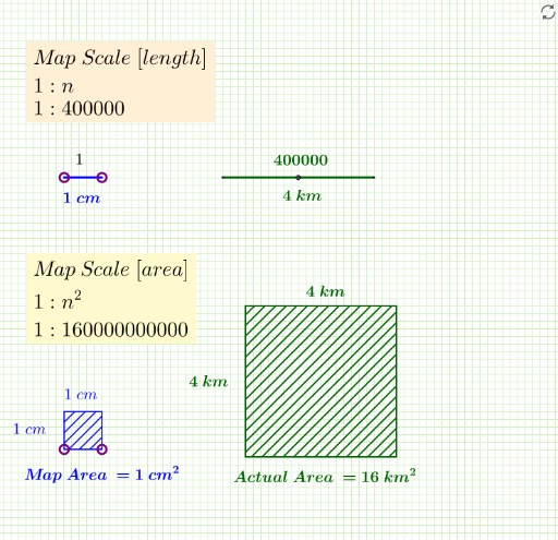
This example demonstrates how to use GeoGebra to construct polygons and calculate the ratio between actual and map areas using scale factors. Key math concepts include map scales, polygon area calculation, and coordinate geometry. Construction involves commands like Segment, Point, Midpoint, Polygon, and objects such as map_.a, map_.b, map_.area. Suitable for high school mathematics education to understand the application of map scales.
GeoGebra Commands & Parameters
Segment(A, B) → map_.aPoint(Circle[C, (map_.a * 4)]) → DSegment(C, D) → act_.aMidpoint(map_.a) → EMidpoint(act_.a) → FPolygon(G, H, 4) → map_.area, map_.b, g, h, i, I, JPoint(Circle[K, (map_.b * 4)]) → LSegment(K, L) → act_.bPolygon(K, L, 4) → act_.area, k, l, m, n, M, NMidpoint(h) → OMidpoint(i) → PMidpoint(n) → QMidpoint(m) → R