
Bearings Map of Europe
Loading the math board and drawing, please wait…
In collections
GCSE Higher Ch8 Transformations & Constructions
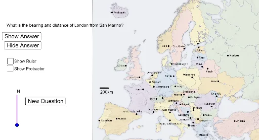
This example demonstrates calculating bearings between European cities on a map, involving core math concepts like bearings, trigonometry, vectors, and coordinate geometry. It is constructed using commands like Segment, RandomElement, Element, Text, Angle, Circle, Point, Line and is suitable for high school mathematics teaching to practice geometric and trigonometric applications.
GeoGebra Commands & Parameters
Segment(I_1, J_1) → aRandomElement(index) → city1RandomElement(index1) → city2Element(city1, 1) → coord1Element(city2, 1) → coord2Text((((("What is the bearing and distance of " * Element[city1, 2]) * " from ") * Element[city2, 2]) * "?"), Z) → questiontextAngle(coord1, coord2, Point[coord2, Vector[(0, 1)]]) → angle1Circle(N_1, 10) → cPoint(c) → O_1Point(coord2, Vector[(0, 2)]) → northcoordText("N", Point[northcoord, Vector[(0, 0.25)]]) → northtextSegment(coord2, northcoord) → northlineSegment(coord1, coord2) → bearinglineLine(P_1, northline) → bPoint(b) → Q_1Segment(P_1, Q_1) → dText("N", Point[Q_1, Vector[(0, 0.25)]]) → text2Text((((("Bearing = " * angle1) * " Distance = ") * distance1) * "km"), K_1) → answertext