
Antarctic Area Calculation
Loading the math board and drawing, please wait…
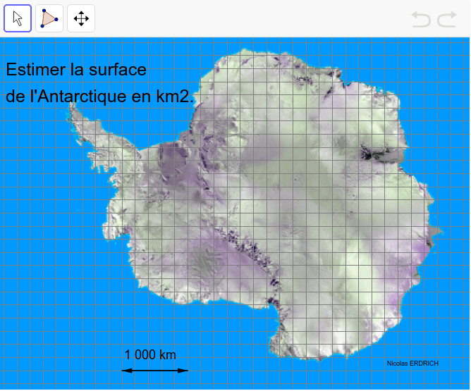
This example demonstrates how to calculate the surface area of Antarctica through geometric constructions. It involves core math concepts like solid geometry, vector operations, and coordinate geometry. Key GeoGebra commands used include Segment and Vector to create basic geometric elements (A, B, C, D) and vectors (u, v), with objects like image2, texte1, etc., for labeling and display. Suitable for high school students learning solid geometry and spatial vectors.
GeoGebra Commands & Parameters
Segment(C, D) → aVector(C, D) → uVector(D, C) → v
AI Drawing Prompt Reference
Draw a geometric figure consisting of two line segments and two vectors to illustrate the calculation method for the surface area of Antarctica. Start by drawing a line segment CD, then create two vectors based on this segment: vector u pointing from C to D and vector v pointing from D to C, representing different directions and lengths for subsequent geometric constructions and calculations.
The prompt above was compiled from the original drawing commands and is for reference only.