
Bosnian Bearings: Exploring Angles and Reflection in Navigation
Loading the math board and drawing, please wait…
In collections
GCSE Higher Ch8 Transformations & Constructions
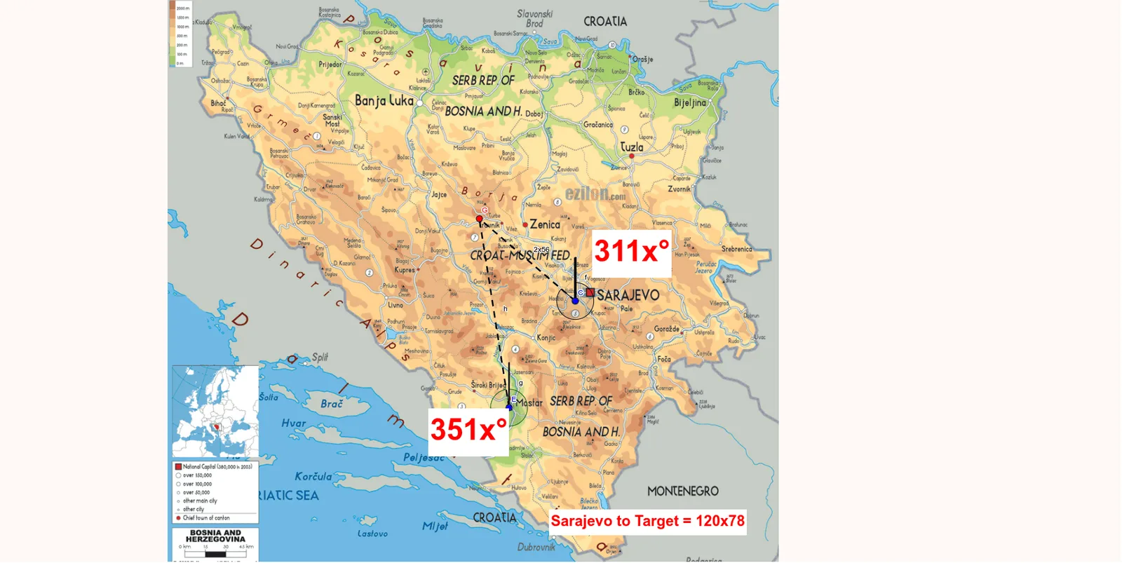
This GeoGebra example demonstrates the geometric concept of bearings (directional angles measured clockwise from north) within a Bosnian map context, focusing on angle measurement and reflection. The core mathematical concepts include angles, bearings, reflection transformations, and percentages (likely used for scale or directional deviation). The construction uses the Segment command to create base lines and the Angle command to mark key angles α and β, with objects such as E, C, j, A, B, D, f, F, g, G, i, h, and s forming the geometric framework. Text objects (text1, text2, text3) provide labels, and a scale object assists in measurement. This example is suitable for middle and high school mathematics, helping students connect abstract bearing concepts with real-world navigation, understand angle measurement and reflection, and apply these ideas in interdisciplinary geography-math lessons.
GeoGebra Commands & Parameters
Segment(E, C) → jSegment(C, D) → fSegment(E, F) → gSegment(C, G) → iAngle(G, C, D) → αSegment(E, G) → hAngle(G, E, F) → β