
Dilations Exploration: Scaling Polygons and Distance Relationships
Loading the math board and drawing, please wait…
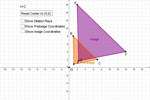
This interactive GeoGebra example demonstrates the concept of dilation in plane geometry, showing how a polygon scales about a center point O with a user-controlled factor. It visualizes the transformation of vertices and edges, and dynamically displays distances between corresponding points (e.g., OF, FC, BC, EF) to illustrate how lengths scale proportionally. Core mathematical concepts include dilation, similarity, scale factor, and the multiplicative property of distances under homothety. The construction uses GeoGebra commands such as Polygon to define the original shape, Dilate to generate the scaled copy, Ray to guide the scaling direction, Textfield and inputBox1 for entering the scale factor, Distance to compute key segment lengths, and button1 to trigger actions. Suitable for middle-to-high school students exploring geometric transformations, and for teachers demonstrating dynamic properties of dilation in a classroom setting.
GeoGebra Commands & Parameters
Polygon(B, C, A) → poly1, d, b, cDilate(B, a, O) → EDilate(C, a, O) → FDilate(A, a, O) → DPolygon(E, F, D) → poly1', d', b', c'Ray(O, E) → eRay(O, D) → fRay(O, F) → gTextfield(a) → inputBox1Distance(O, F) → distanceOFDistance(F, C) → distanceFCDistance(B, C) → distanceBCDistance(E, F) → distanceEFDistance(D, F) → DFDistance(A, C) → ACDistance(F, E) → FEDistance(C, B) → CB