
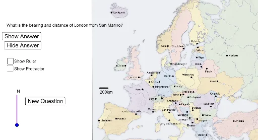
欧洲城市方位角地图
几何画板及绘图内容加载中,请稍等……
①本范例演示如何在欧洲地图上计算城市间的方位角;②涉及的核心数学概念包括方位角、三角函数、向量与解析几何;③作图要点——使用了Segment、RandomElement、Element、Text、Angle、Circle、Point、Line等GeoGebra命令与对象;④适合高中数学教学,用于实践几何与三角函数应用。
GeoGebra 命令及参数
Segment(I_1, J_1) → aRandomElement(index) → city1RandomElement(index1) → city2Element(city1, 1) → coord1Element(city2, 1) → coord2Text((((("What is the bearing and distance of " * Element[city1, 2]) * " from ") * Element[city2, 2]) * "?"), Z) → questiontextAngle(coord1, coord2, Point[coord2, Vector[(0, 1)]]) → angle1Circle(N_1, 10) → cPoint(c) → O_1Point(coord2, Vector[(0, 2)]) → northcoordText("N", Point[northcoord, Vector[(0, 0.25)]]) → northtextSegment(coord2, northcoord) → northlineSegment(coord1, coord2) → bearinglineLine(P_1, northline) → bPoint(b) → Q_1Segment(P_1, Q_1) → dText("N", Point[Q_1, Vector[(0, 0.25)]]) → text2Text((((("Bearing = " * angle1) * " Distance = ") * distance1) * "km"), K_1) → answertext