
G.GCI.3 Where in Horry County part 2?
Loading the math board and drawing, please wait…
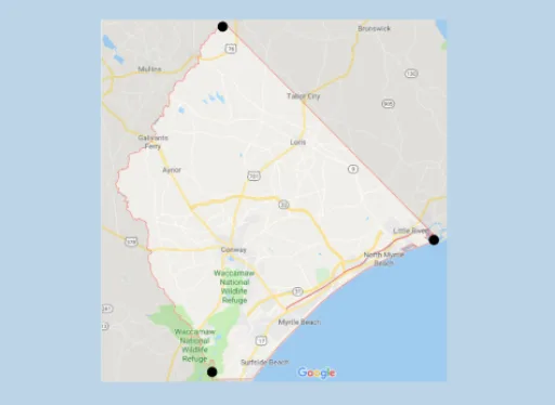
This example demonstrates how to locate the incenter of a triangle formed by points on a real map of Horry County. The core mathematical concept is the incenter, the intersection point of the three angle bisectors, which is equidistant from all sides and serves as the center of the incircle. Construction involves using GeoGebra's Point command to place vertices A, B, C on the map images (pic1, pic2), then determining the incenter via angle bisectors or built-in tools. Suitable for middle or high school geometry, this activity connects abstract triangle properties to a real-world context, reinforcing understanding of angle bisectors and their applications.
GeoGebra Commands & Parameters
Point(yAxis) → C
AI Drawing Prompt Reference
Draw a triangle on a real map with vertices in different areas, then locate the incenter, which is the intersection of the three angle bisectors and equidistant from all sides, also serving as the center of the incircle. Illustrate this by drawing the angle bisectors and the incircle.
The prompt above was compiled from the original drawing commands and is for reference only.